

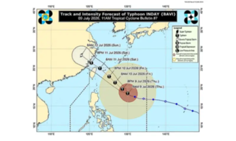
Bagyong Inday (international name: Bavi) weakened on Thursday morning, July 9, 2026, but remained a strong typhoon as it moved northwest over the Philippine Sea, according to the Philippine Atmospheric, Geophysical and Astronomical Services Administration (Pagasa).
Current status and location
In its 11 a.m. bulletin, Pagasa estimated the typhoon's eye at 865 kilometers east of Northern Luzon as of 10 a.m. Inday carried maximum sustained winds of 165 kilometers per hour (km/h) and gusts of up to 205 km/h, moving northwest at 15 km/h.
Signal warnings raised
Pagasa placed Batanes under Tropical Cyclone Wind Signal (TCWS) No. 2, with winds ranging from 62 to 88 km/h expected within the next 24 hours. These winds pose a minor to moderate threat to life and property.

TCWS No. 1 remains in effect over the following areas:
- Cagayan, including Babuyan Islands
- Isabela
- Northeastern Quirino
- Apayao
- Northern Abra
- Kalinga
- Eastern Mountain Province
- Eastern Ifugao
- Ilocos Norte
- Northern Aurora
- Northern and central parts of Catanduanes
Areas under Signal No. 1 will experience strong winds of 39 to 61 km/h, which may cause minimal damage.
Enhanced habagat effect
Even outside the signal areas, Pagasa warned that the enhanced southwest monsoon (habagat), combined with Inday's outer circulation, will continue to bring strong to gale-force gusts across much of the country from Thursday through Saturday, July 11, especially in coastal and mountainous areas exposed to the wind.