The Department of Science and Technology (DOST) has proposed to the Department of Budget and Management (DBM) a science and technology-based concept and system designed to combat and prevent corruption in infrastructure programs. This initiative comes as the country grapples with corruption issues stemming from billions of pesos worth of infrastructure projects that were discovered to be nonexistent or ghost projects.
Digital Intelligence for Monitoring
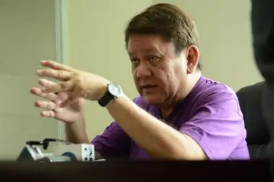
“We actually submitted to DBM a concept of how to really use digital intelligence to monitor and evaluate infrastructure projects,” DOST Secretary Renato Solidum said during a press conference on September 25 at the opening of the Regional Science, Technology and Innovation Week 2025 in Abreeza Mall, Davao City.
The first step of the concept requires that every infrastructure proposal undergo evaluation, and that the infrastructure plan should not be decided solely by a single group. The scientific community could also assist in evaluating proposals.

Integrated Master Planning
“All infrastructure should be part of an integrated master plan. We talk about climate change, we talk about excess water or no water. The best plan is what we call Integrated Water Resource Management,” Solidum said.
He added that if the problem is excess rain, then the infrastructure would involve water impounding structures like dams. “And if we talk about ensuring that the water will stay in the pathway of the river, then we need to forecast and decide the project, what kind of flood are we protecting the people from? Is it the normal flood every five years or is it 15 years?” Solidum explained.
He emphasized that science is also needed to study the erosive capacity of the river, as water conveys not just water but also stones, boulders, and sand. “The erosive capacity is different from river to river,” the DOST secretary said. The design of flood control must include factors such as the projected discharge that would protect the community.
Digital Models and Monitoring
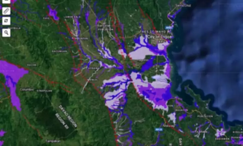
After submission of the design and location, it would be compared to the digital terrain model of the entire country. “In Mindanao, we funded the Geomapper Mindanao with all the LiDAR (Light Detection and Ranging) data. We used universities in Mindanao to look that up, and these are available,” Solidum said.
By using digital prints of towns, authorities can simulate the effect of infrastructure development such as roads, dikes, and residential subdivisions on potential flood scenarios. Technology will also be used to monitor projects using satellite technology, drones, and citizen reporting via digital applications.
“If we can have an application where we can use the details of the project in the app, then anyone can compare and contrast,” Solidum said.
Promoting Transparency
The country’s science chief says that the digital application equipped with GIS (Global Information System) will promote transparency, preventing or at least limiting corruption in infrastructure projects. He noted that the concept was already tested in 2018 and 2019.
“DOST funded a project at that time, now operated by DBM. We monitored the National Greening Program and the National Irrigation Infrastructure Program,” Solidum said.
He stated that the science-based approach to fighting and lessening corruption in infrastructure projects is not difficult to implement. The DOST secretary revealed that the DBM is interested in the concept. “The DBM met with me, and they are interested in what we are doing,” Solidum said.