Super Typhoon Bavi (international name) intensified into a super typhoon on Friday evening, July 3, while moving westward outside the Philippine Area of Responsibility (PAR), according to the Philippine Atmospheric, Geophysical and Astronomical Services Administration (PAGASA).
Typhoon Details
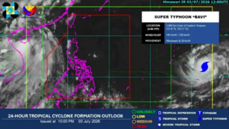
In its weather bulletin issued around 10 p.m., PAGASA reported that the super typhoon has maximum sustained winds of 185 kilometers per hour near the center and gusts of up to 230 kph. The storm was estimated to be 3,090 kilometers east of Eastern Visayas, moving westward at 20 kph.
Potential Entry into PAR
The state weather bureau said the typhoon could enter PAR on Wednesday, July 8, and would be locally named “Inday.” According to the latest tropical cyclone threat assessment from PAGASA, there is a high probability that the super typhoon will pass near Northern Luzon next week, which may lead to the hoisting of tropical cyclone wind signals over large parts of the region and some areas in Central Luzon.

Current Weather Conditions
For now, the easterlies are affecting the country’s weather. PAGASA continues to monitor the storm's movement and will issue updates as necessary.