
Multiple Weather Systems Bring Widespread Rains Across Philippines
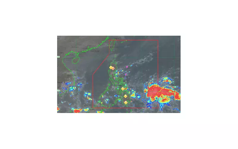
The Philippine Atmospheric, Geophysical and Astronomical Services Administration (PAGASA) reported Sunday that a low pressure area located outside the Philippine Area of Responsibility and four additional weather systems will cause rainfall across most regions of the country.
In their 5 a.m. bulletin released on November 23, 2025, weather specialists identified the LPA approximately 1,130 kilometers east of Southern Mindanao. The weather disturbance is anticipated to enter the PAR within the day.
Potential Development into Tropical Depression
PAGASA weather specialist Obet Badrina stated that the low pressure area currently has a medium probability of intensifying into a tropical depression during the next 24 hours. Once the system crosses into the Philippine Area of Responsibility, it will receive the name Verbena.

Badrina emphasized that the weather system is expected to generate moderate to heavy rainfall in Eastern Visayas, Central Visayas, and the Caraga region once it enters Philippine territory.
Current Weather Conditions Across Regions
Several areas are already experiencing adverse weather conditions due to the approaching low pressure area. Northern Mindanao, Caraga, Davao Region, Eastern Visayas, and Bohol currently have cloudy skies with scattered rain showers and thunderstorms.
The shear line continues to affect Apayao, Cagayan, Isabela, and Quirino, bringing cloudy conditions with scattered rains and isolated thunderstorms.
In the Cordillera Administrative Region and remaining parts of Cagayan Valley, cloudy skies with rain persist due to the northeast monsoon or "amihan." The Ilocos Region experiences partly cloudy to cloudy conditions with isolated light rains, also influenced by the amihan.
The Intertropical Convergence Zone affects the rest of Mindanao, resulting in partly cloudy to cloudy skies with isolated rain showers or thunderstorms.
Easterlies are bringing cloudy conditions with scattered rains and thunderstorms to Aurora, Quezon, and Camarines Norte.
Metro Manila and other parts of the country will experience partly cloudy to cloudy skies with isolated rain showers or thunderstorms, also caused by easterlies.
Extreme northern Luzon will experience strong northeast winds and rough coastal waters, according to PAGASA's forecast.
Residents in affected areas are advised to monitor updates from PAGASA and take necessary precautions against potential flooding and landslides triggered by heavy rainfall.


