The Philippine Atmospheric, Geophysical and Astronomical Services Administration (PAGASA) is monitoring a weather disturbance with a high chance of turning into a tropical storm in the coming day.
Potential Development into Cyclone Wilma
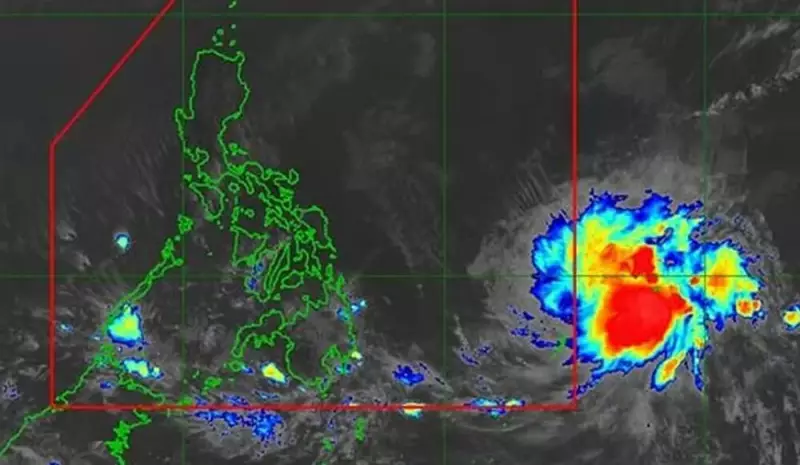
As of its latest bulletin, a low pressure area (LPA) was spotted 1,290 kilometers east of Eastern Visayas, outside the Philippine Area of Responsibility (PAR). PAGASA weather specialist Chenel Dominguez stated on Tuesday that this system has a high potential to develop into a tropical cyclone within the next 24 hours.
Once the weather disturbance enters the PAR, it will be given the local name Wilma. Current forecasts indicate it could make landfall over the Eastern Visayas or Caraga regions. However, Dominguez cautioned that the forecast track still carries high uncertainty.

Precautionary Advisories for Key Regions
Residents in the Bicol Region, Eastern Visayas, and Mindanao are advised to start taking precautions against potential heavy rainfall beginning Friday. PAGASA emphasizes the importance of staying informed and prepared.
"Check regular updates from PAGASA. Coordinate with your local government units regarding possible evacuation advisories," Dominguez urged the public.
Current Weather Conditions Nationwide
Meanwhile, other weather systems are affecting parts of the country. Mindanao is experiencing scattered rains and thunderstorms on Tuesday due to the Intertropical Convergence Zone (ITCZ) affecting its southern portion. PAGASA warned that moderate to heavy rains on the island could lead to flash floods or landslides.
In the far north, Batanes and Babuyan Islands will have isolated light rains caused by the northeast monsoon, locally known as amihan.
For the rest of the Philippines, isolated rain showers are expected due to localized thunderstorms. The state weather bureau added that the entire archipelago will continue to experience light to moderate winds and slight to moderate seas.
The public, especially those in potentially affected areas, are reminded to monitor official PAGASA bulletins for the latest developments on this potential cyclone.