
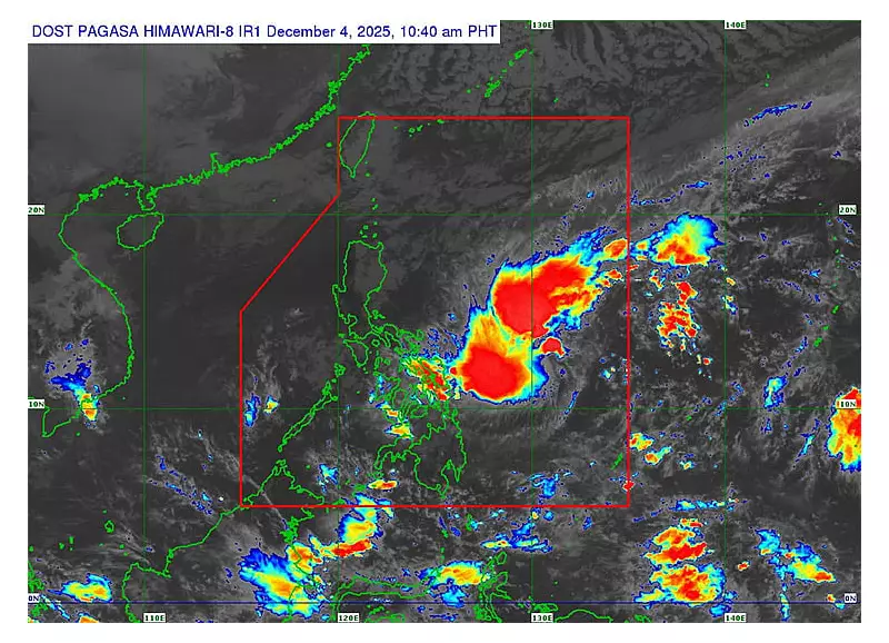
The state weather bureau is now on alert as a new weather disturbance strengthens over the Philippine Sea. The Philippine Atmospheric, Geophysical and Astronomical Services Administration (Pagasa) reported that a low pressure area developed into Tropical Depression Wilma on the morning of Thursday, December 4, 2025.
Current Location and Movement
Pagasa weather specialist Ana Dumdum announced that the intensification occurred around 8 a.m. on December 4, leading to the issuance of the first tropical cyclone bulletin. As of the 10 a.m. update, the cyclone's center was located approximately 600 kilometers east of Northern Samar.
Although still classified as a tropical depression, Wilma already packs maximum sustained winds of 45 to 55 kilometers per hour. Its influence extends far, with strong winds reaching up to 200 kilometers from the center.

The weather system is currently moving in a west-southwest direction at a speed of about 20 kilometers per hour. Dumdum described this pace as moderate, neither too slow nor excessively fast.
Forecast Track and Potential Impact
Pagasa's analysis indicates that Wilma will gradually move closer to the Philippine archipelago. Its projected path is generally westward, potentially tracking toward the central provinces, including Cebu.
The bureau forecasts a possible landfall over Eastern Samar, Eastern Visayas, or Dinagat Island. This critical event is expected to occur either on the night of December 5 or the morning of December 6, 2025.
"Although this system is still a tropical depression, it still carries strong winds. Its rainbands could start affecting areas as early as tomorrow (December 5)," Dumdum cautioned. She emphasized that even areas not directly under the storm's eye will experience effects due to its wide rainbands.
Extended Rainfall and Public Advisory
The cyclone's slow movement is a primary concern. Dumdum warned the public to prepare for prolonged rainfall over the next three days, significantly raising the risks of flooding and landslides, especially in geologically vulnerable communities.
Rains are anticipated over Central and Western Visayas starting Friday and lasting through Saturday as Wilma begins to cross the region. The storm is expected to traverse the Visayas until Monday, December 8, before exiting toward the Sulu Sea and heading in the direction of Palawan by Monday or Tuesday.
Pagasa reminds everyone to continuously monitor official updates, as tropical cyclone bulletins are issued every six hours. While the current track is established, forecast uncertainty remains, meaning the storm could still shift slightly north or south of its expected path.
"We encourage everyone to stay updated. Tracks can shift, and being informed is the best way to prepare," Dumdum concluded.


