CEBU, Philippines - Typhoon Tino has entered the Philippine Area of Responsibility (PAR), bringing significant weather disturbances to the Central Visayas region, particularly Cebu, according to the latest bulletin from the Philippine Atmospheric, Geophysical and Astronomical Services Administration (PAGASA).
Storm Intensity and Movement
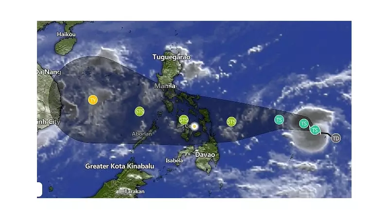
The weather disturbance, now officially named Typhoon Tino, was last tracked approximately 1,195 kilometers east of Southeastern Luzon. The typhoon continues to move in a west-northwestward direction, packing maximum sustained winds of 65 kilometers per hour near the center and gustiness reaching up to 80 kilometers per hour.
Weather Impact on Cebu
Residents across Cebu province should prepare for moderate to heavy rainfall conditions throughout the day. The combination of the typhoon's circulation and the prevailing shear line is expected to produce substantial precipitation that may lead to potential flooding in low-lying areas and landslides in mountainous regions.

Maritime Safety Advisory
PAGASA has issued critical warnings for sea travelers and fisherfolk. Coastal waters surrounding Cebu and neighboring islands are anticipated to experience rough to very rough sea conditions. Small seacraft are strongly advised to remain in port, while larger vessels should exercise extreme caution when navigating these waters.
Precautionary Measures
- Monitor official weather updates regularly from PAGASA
- Prepare emergency kits with essential supplies
- Secure loose outdoor items that might be carried by strong winds
- Avoid unnecessary travel, especially in flood-prone areas
- Have evacuation plans ready for families in high-risk zones
Local disaster risk reduction management offices throughout Cebu have been placed on alert status, coordinating with barangay officials to ensure prompt response to any emergency situations that may arise from Typhoon Tino's impact.