The Philippines received positive weather news as Typhoon Uwan has downgraded to a severe tropical storm while moving away from the country's area of responsibility. According to the Philippine Atmospheric, Geophysical and Astronomical Services Administration (PAGASA), the weather system continues to pose some threats to northern regions despite its weakening status.
Current Storm Position and Movement
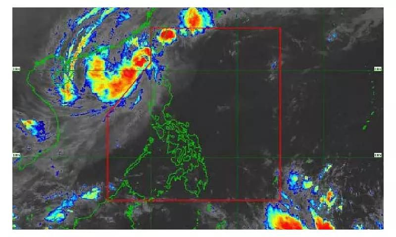
As of Tuesday morning, November 11, 2025, PAGASA reported that Uwan's center was positioned approximately 370 kilometers west-northwest of Calayan, Cagayan. The storm maintains a north-northwestward track at a speed of 10 kilometers per hour while packing maximum sustained winds of 110 kilometers per hour near its center.
The weather disturbance also generates gustiness reaching up to 135 kilometers per hour. PAGASA forecasts that Uwan will continue moving north throughout Tuesday before shifting to a northeast direction from Tuesday night until Thursday.

Wind Signals and Affected Areas
Several regions in Northern Luzon remain under tropical cyclone wind signals as the storm influences local weather conditions. Tropical Cyclone Wind Signal No. 2 remains hoisted over Batanes and the western portion of Ilocos Norte, where residents should prepare for gale-force winds that could cause minor to moderate impacts to life and property.
Meanwhile, TCWS No. 1 covers multiple provinces including:
- Parts of Cagayan, Apayao, and Abra
- Kalinga, Mountain Province, and Benguet
- Ilocos Norte, Ilocos Sur, and La Union
- Pangasinan
These areas may experience strong winds that could result in minimal to minor damage.
Weather Impacts and Forecast
PAGASA indicates that Uwan will continue to bring occasionally gusty conditions across most of Luzon, Western Visayas, Negros Island Region, and Northern Samar. The weather pattern shows gusty winds potentially prevailing over the Ilocos Region, Cagayan Valley, Bicol Region, and parts of Central Luzon by Wednesday.
By Thursday, the gusty conditions may persist specifically over Batanes and Babuyan Islands. Meteorologists are closely monitoring the storm's potential re-entry into the Philippine Area of Responsibility, which could occur as early as Wednesday evening as the system approaches southwestern Taiwan, where landfall is expected.
Residents in affected areas should continue monitoring official updates from PAGASA and take necessary precautions against possible strong winds and associated weather disturbances. The gradual weakening of the storm provides some relief, but remaining vigilant remains crucial for communities in northern Philippines.