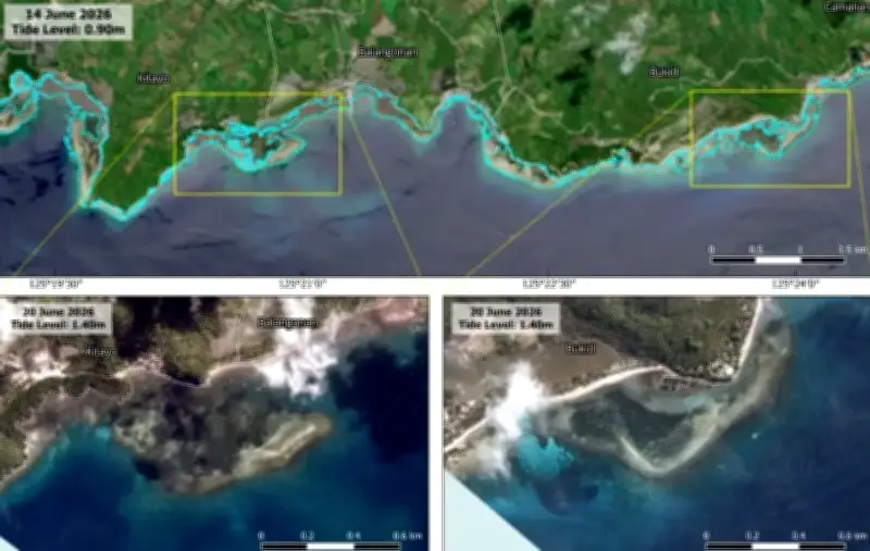
The Philippine Space Agency (PhilSA) documented a significant coastal uplift in Davao Occidental following the magnitude 7.8 earthquake that struck on June 8, 2026. Satellite images released by PhilSA show the sea receding from former shorelines, with the coastline visibly moving away from residential areas.
Satellite Data Reveals 179 Hectares of Uplifted Coastline
According to PhilSA, before-and-after satellite imagery indicates that approximately 179 hectares of coastal land were uplifted. The agency utilized Sentinel-2 and BlackSky satellite images to measure changes and assist in damage assessment. The technology will also aid in planning protective measures for uplifted coastal areas and formulating policies such as no-build zones.
Previous Reports from Sarangani
Earlier, the Department of Environment and Natural Resources reported that in the neighboring province of Sarangani, the seabed rose by up to 2 meters and the shoreline retreated by an estimated 200 meters after the strong quake. PhilSA clarified that the released results will undergo ground validation.