The Department of Environment and Natural Resources’ Mines and Geosciences Bureau on Thursday urged local governments to maximize the use of its geohazard maps in their planning and disaster risk reduction efforts.
Geohazard Maps as Planning Tools
In a Bagong Pilipinas Ngayon interview, MGB Assistant Secretary Karlo Queano said the bureau is mandated to provide information on rain-induced landslides, including flooding. “The Mines and Geosciences produce geohazard maps, so this will help in our land use plan,” he stated.
Queano explained that in flood-prone areas, the maps can guide mitigation and adaptation programs. “If we know how high the floodwaters rise, this will help in designing our infrastructure,” he added.

Scientific Basis and Updates
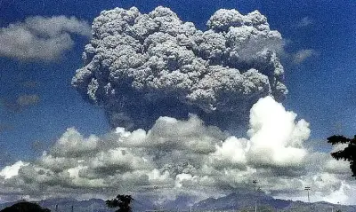
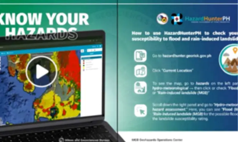
The MGB geohazard maps are detailed scientific tools that identify communities susceptible to rain-induced landslides, floods, and storm surges. They are designed to guide disaster preparedness, evacuation planning, and urban zoning.
Queano noted that the maps are grounded in nationwide field geological assessments that identify rain-induced landslides, flooding pathways, coastal hazards, and subsidence risks. The mapping work began in 2008 and is validated at the barangay level by geologists who conduct site inspections.
He stressed that the maps are not static documents and are regularly updated. “Now, as regularly as possible, we update the maps. We know that over the years, the condition of a place can change due to natural factors as well as interventions made by our fellow citizens,” he said.
Integration into Land-Use Plans
Queano emphasized that geohazard data should directly guide land-use planning and infrastructure design, particularly in high-risk areas. He cited planning applications such as adjustments to building design in flood-prone zones.
Local government units are required to integrate geohazard maps into their land-use plans, in coordination with national agencies and disaster authorities. “So as a science, we provide the science and in terms of the implementation, that is through the help of the Department of the Interior and Local Government and other government agencies,” he said.
Preparing for Extreme Weather
With extreme weather events becoming more frequent, Queano said planning must assume worst-case scenarios, particularly for rainfall, flooding, and sea level rise. He warned that long-term infrastructure, such as seawalls, must be designed with future conditions in mind.
“That is why in our designs, we have to have projections and geo-hazard maps can provide the first information,” he said.
Call to Residents
Queano also warned residents living in high-risk areas to consider relocating or coordinate with their LGUs for proper assistance. “To our fellow citizens, in this time of climate change, we need to be more resilient and take seriously the information provided by our government agencies,” he said.