
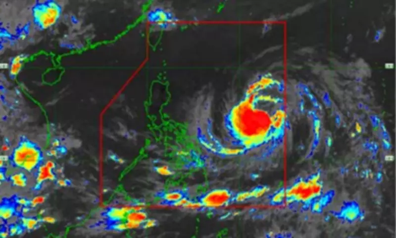
The Philippine Atmospheric, Geophysical and Astronomical Services Administration (PAGASA) reported on Friday that Tropical Storm Domeng has slightly intensified, now carrying maximum sustained winds of 85 kilometers per hour (kph) near its center and gustiness reaching up to 105 kph.
Current Location and Movement
As of 11 a.m., Domeng was located approximately 1,265 kilometers east of southeastern Luzon, moving northwestward at a speed of 15 kph.
No Wind Signal Yet
PAGASA clarified that no wind signal has been hoisted over any part of the country, as the tropical storm is not expected to directly affect the Philippines' weather conditions within the next 24 hours.

Enhanced Southwesterly Windflow
However, Domeng is enhancing the southwesterly windflow, which is forecast to bring heavy rains over the western portions of the country beginning Sunday. Additionally, strong to gale-force gusts are expected in many areas starting Saturday.
Intensification Forecast
The weather bureau noted that Domeng will continue to intensify and may reach typhoon category on Saturday while remaining over the Philippine Sea. Afterward, the tropical cyclone is expected to steadily weaken.
Landfall and Exit
Domeng is less likely to make landfall and could possibly exit the Philippine Area of Responsibility (PAR) on Monday, according to PAGASA.