
The Philippine Atmospheric, Geophysical and Astronomical Services Administration (PAGASA) announced on Sunday, January 11, 2026, that three major weather systems will continue to influence conditions across the archipelago, bringing rains and thunderstorms to various regions.
Regional Weather Impacts and Forecast
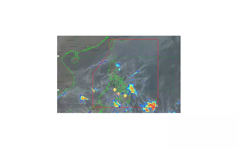
In its 4 a.m. advisory, the state weather bureau detailed the specific effects of the northeast monsoon, shear line, and easterlies. The northeast monsoon, locally known as amihan, is affecting a significant portion of Luzon. This will result in cloudy skies with light rains over Metro Manila, the Cordillera Administrative Region, the rest of Cagayan Valley, Nueva Ecija, Bulacan, and Calabarzon (excluding Quezon province).
The Ilocos Region and the remaining parts of Central Luzon can expect partly cloudy to cloudy conditions with isolated light rains, also due to the influence of the amihan.

A shear line is impacting Quezon province, along with Cagayan, Isabela, and Aurora. Residents in these areas should prepare for cloudy skies with scattered rains and isolated thunderstorms.
Visayas and Mindanao Under Easterlies
The eastern sections of the country are under the sway of easterlies. The Bicol Region, Eastern Visayas, Dinagat Islands, Surigao del Norte, and Surigao del Sur will experience cloudy skies with scattered rains and thunderstorms.
For the rest of the Philippines, the forecast calls for partly cloudy to cloudy skies with isolated rain showers or thunderstorms, also triggered by the easterlies.
Marine and Coastal Conditions
PAGASA also issued a gale warning for several coastal areas. Northern Luzon and the eastern section of Central Luzon will have moderate to rough coastal waters due to moderate to strong northeast winds.
The rest of Luzon and the eastern sections of Visayas and Mindanao will also experience moderate to strong winds blowing from the east to northeast, leading to moderate to rough seas. Meanwhile, the remaining parts of the country will have light to moderate northeast to north winds and slight to moderate coastal waters.
Monitoring a Potential Low Pressure Area
As of the latest monitoring, PAGASA confirmed that no low pressure area (LPA) is currently being tracked inside or outside the Philippine Area of Responsibility.
However, weather forecaster Obit Badrina provided an important update. He indicated that a "potential" LPA might develop between Wednesday and Friday of this week. If this system forms, it is expected to bring scattered rains over the eastern section of Visayas and Mindanao, including the Bicol Region. The public is advised to stay updated with the latest weather bulletins from PAGASA.


