
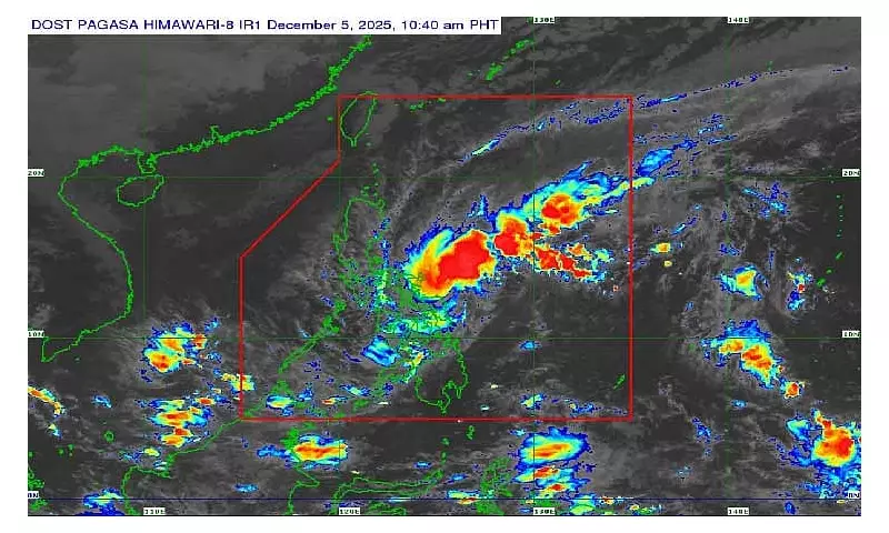
The Philippine Atmospheric, Geophysical and Astronomical Services Administration (PAGASA) reported that Tropical Depression Wilma maintained its strength as of Friday morning, December 5, 2025. The weather disturbance continues to prompt Tropical Cyclone Wind Signal No. 1 over numerous provinces, primarily in the Visayas and parts of Mindanao.
Current Strength and Movement
In its 11 a.m. bulletin, PAGASA stated that Wilma packs maximum sustained winds of 45 kilometers per hour (kph) near the center and gustiness of up to 55 kph. The state weather bureau last located the tropical depression's center approximately 235 kilometers east of Borongan City in Eastern Samar.
The weather system is currently moving in a west-southwest direction at a speed of 15 kph. PAGASA forecasts that Wilma will likely remain a tropical depression and could make landfall or pass very close to the Eastern Visayas or Dinagat Islands area between Friday night and Saturday.

Areas Under Signal No. 1
Residents in the following areas should prepare for strong winds associated with the tropical depression. The list includes several provinces and specific municipalities:
- Bicol Region: Southern portion of Sorsogon and mainland Masbate including Ticao Island.
- Visayas: The entire Samar provinces (Northern, Eastern, and Samar), Biliran, Leyte, Southern Leyte, Cebu (including Bantayan and Camotes Islands), Bohol, Siquijor, Guimaras, and significant portions of Negros Occidental, Negros Oriental, Iloilo, and Capiz.
- Mindanao: Surigao del Norte (including Siargao and Bucas Grande Islands), Dinagat Islands, the northern portion of Surigao del Sur, the northern portion of Agusan del Norte, and Camiguin Island.
Local disaster risk reduction and management offices in these localities are advised to take necessary precautionary measures.
Additional Weather Hazards
PAGASA also highlighted that the prevailing northeast monsoon, or amihan, will induce strong to gale-force gusts across most of Luzon and the Visayas, even outside the tropical cyclone wind signals.
A gale warning remains in effect for several seaboards. Rough to very rough seas are expected over the northern and western seaboards of Northern Luzon and the eastern seaboards of both Luzon and the Visayas. This condition makes sea travel risky for most vessels, and fishermen and those with small boats are strongly advised not to venture out into these waters.
The public is urged to continue monitoring updates from PAGASA and their local government units for the latest information and advisories regarding Tropical Depression Wilma and the enhanced monsoon conditions.


