
The state weather bureau has raised Tropical Cyclone Wind Signal (TCWS) No. 1 over more areas, including parts of Cebu and Bohol, as Tropical Depression Wilma approaches the eastern seaboard.
Wilma's Current Position and Strength
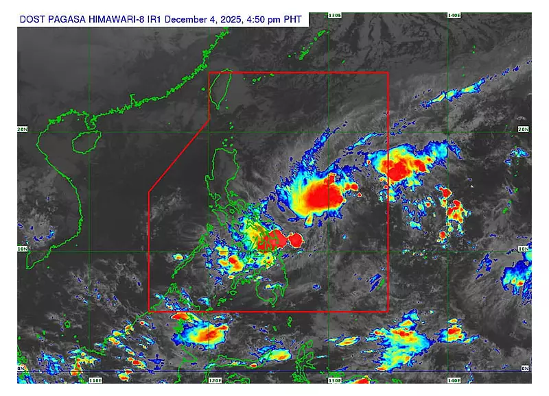
In its 5 p.m. bulletin on Thursday, December 4, 2025, the Philippine Atmospheric, Geophysical and Astronomical Services Administration (Pagasa) reported that Wilma had slowed down while moving closer to the Philippine landmass. The cyclone was located approximately 575 kilometers east of Catarman, Northern Samar, as of 4 p.m.
The weather disturbance carries maximum sustained winds of 45 kilometers per hour and gusts reaching up to 55 km/h. Its central pressure was recorded at 1004 hPa. Pagasa noted it was tracking in a west-southwest direction at a speed of 10 km/h.

Areas Under Tropical Cyclone Wind Signal No. 1
The following localities are now under TCWS No. 1, indicating winds of 39 to 61 km/h may be expected within 36 hours:
- The southern portion of mainland Masbate (Cataingan, Pio V. Corpuz, Esperanza, Placer).
- Northern Samar, Eastern Samar, Samar, Biliran, Leyte, and Southern Leyte.
- The northern portion of Cebu, including Daanbantayan, Medellin, City of Bogo, San Remigio, Tabogon, Borbon, Tabuelan, Tuburan, Sogod, Catmon, Asturias, Carmen, Danao City, Balamban, Compostela, Liloan, Consolacion, Cebu City, Mandaue City, Cordova, and Lapu-Lapu City. This also covers Bantayan and Camotes Islands.
- The eastern and central portions of Bohol, encompassing towns like Inabanga, Carmen, Talibon, Ubay, and Trinidad, among others listed.
- Surigao del Norte (including Siargao and Bucas Grande Islands), Dinagat Islands, the northern part of Surigao del Sur, and the northern portion of Agusan del Norte.
Forecast Track and Potential Impacts
Pagasa forecasts that Wilma will maintain a west-southwestward movement until Saturday, December 6, before shifting to a general westward track in the following days. The cyclone's center is likely to make initial landfall over Eastern Visayas or Dinagat Islands between Friday evening, December 5, and Saturday morning, December 6.
"Afterwards, it will continue to traverse Visayas until Sunday, December 7," Pagasa stated. The weather system is then projected to emerge over the Sulu Sea and may pass over northern Palawan between Sunday evening and Monday morning, December 8.
While Wilma may intensify slightly before hitting land, the bureau expects it to remain a tropical depression throughout the forecast period. Residents in the affected areas are advised to monitor further updates from Pagasa and prepare for possible gusty winds and associated rains.


