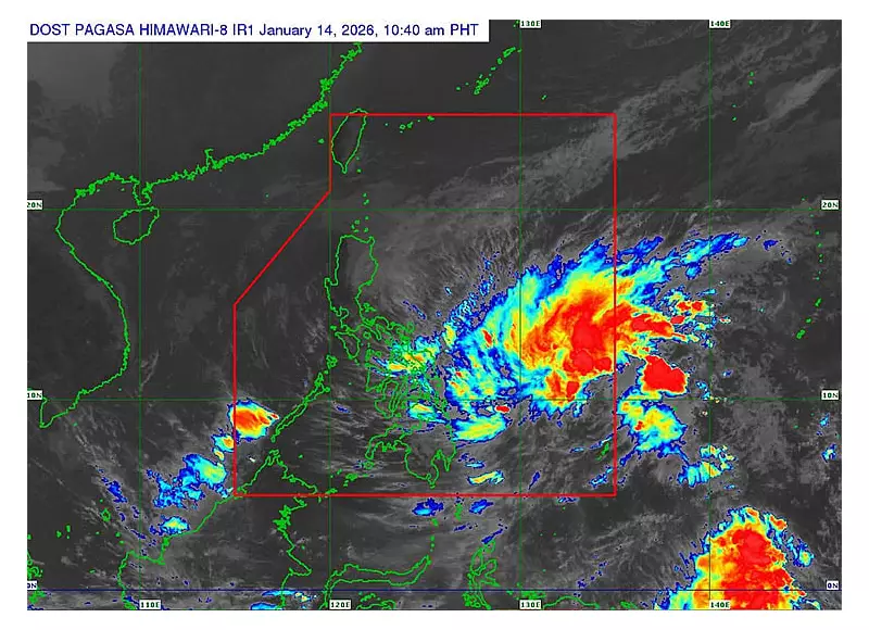
The Philippine Atmospheric, Geophysical and Astronomical Services Administration (Pagasa) announced on Wednesday morning, January 14, 2026, that a low pressure area (LPA) east of Mindanao has strengthened into a tropical cyclone.
Ada's Current Location and Strength
This new weather disturbance, now named Tropical Depression Ada, was last located 635 kilometers east of Hinatuan, Surigao del Sur. As of the 10 a.m. advisory, Ada packed maximum sustained winds of 45 kilometers per hour and gusts reaching up to 55 km/h. Its central pressure was recorded at 1004 hPa.
The state weather bureau reported that the tropical depression is moving in a northwestward direction at a speed of 35 km/h.
Areas Under Tropical Cyclone Wind Signal
In response to the developing threat, Pagasa has hoisted Tropical Cyclone Wind Signal (TCWS) Number 1 over several provinces. This initial warning signals potentially strong winds within the next 36 hours.
The affected areas in the Visayas region are Northern Samar, Samar, and Eastern Samar. In Mindanao, the signal is in effect for Dinagat Islands, Surigao del Norte, and Surigao del Sur.
Pagasa cautioned that the highest wind signal likely to be raised during Ada's passage is TCWS Number 2.
Forecast Track and Intensification
Pagasa's forecast indicates that Ada will maintain a west-northwestward to northwestward track over the coming three days. The cyclone is expected to pass close to or make landfall over Eastern Visayas on Friday, January 16, or early Saturday, January 17.
Following that, it is projected to approach or hit Catanduanes on Saturday or Sunday (January 18). Afterwards, Ada is predicted to recurve and move generally northeastward over the Philippine Sea east of Luzon.
In terms of strength, Ada is forecast to intensify into a tropical storm within the next 24 hours. Gradual intensification is expected as it moves over the Philippine Sea.
Additional Weather Hazards
Beyond the direct effects of the cyclone, Pagasa warned that the combined influence of the northeast monsoon (amihan) and Ada's outer circulation will bring strong to gale-force gusts to several areas, particularly in exposed coastal and upland locations.
On January 14, affected areas include Batanes, Babuyan Islands, Ilocos Norte, Abra, parts of Cagayan and Isabela, eastern Bulacan, Aurora, most of Quezon, and several Bicol provinces.
On January 15, the gusty conditions are forecast for areas including Batanes, Babuyan Islands, parts of Northern Luzon, Aurora, CALABARZON, several island provinces, the Bicol Region, and Central Visayas.
By January 16, the affected zone expands further to cover most of Visayas and most of Caraga region, in addition to the previously mentioned areas in Luzon.


