The year 2026 has seen its first tropical cyclone enter the Philippine Area of Responsibility. What was once a low-pressure area east of Mindanao intensified into a tropical depression on Wednesday, January 14, 2026, and has been given the local name Ada by the state weather bureau.
Current Location and Movement
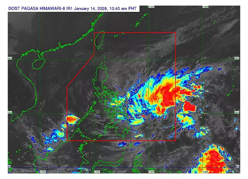
As of 10:00 AM on January 14, the Philippine Atmospheric, Geophysical and Astronomical Services Administration (Pagasa) located Tropical Depression Ada approximately 635 kilometers east of Hinatuan, Surigao del Sur. The weather disturbance is moving in a northwest direction at a speed of 35 kilometers per hour.
The storm currently packs maximum sustained winds of up to 45 kph near its center, with gustiness reaching up to 55 kph. Pagasa forecasters are closely monitoring its development and potential path.

Areas Under Wind Signal No. 1 and Rainfall Warnings
Pagasa has raised Tropical Cyclone Wind Signal (TCWS) No. 1 over several provinces, indicating winds of 39-61 kph may be experienced within the next 36 hours. The affected areas are:
- Northern Samar
- Samar
- Eastern Samar
- Dinagat Islands
- Surigao del Norte
- Surigao del Sur
Furthermore, heavy rainfall is forecast to affect Eastern Samar, Dinagat Islands, Surigao del Norte, and Surigao del Sur until Thursday. Residents in these areas are advised to be vigilant against possible flash floods and landslides.
Forecast Track and Intensity
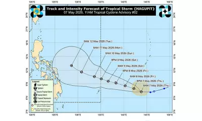
Pagasa predicts that Ada will continue moving generally west-northwestward to northwestward over the next three days. The cyclone is expected to intensify into a tropical storm within the next 24 hours.
Benison Estareja, a Pagasa forecaster, emphasized that while a forecast track is provided, the storm's path remains subject to change. Current projections indicate Ada may make a close approach or landfall in the Eastern Visayas region by Friday or Saturday. Subsequently, it is forecast to pass near or make landfall in Catanduanes on Saturday or Sunday.
Pagasa also stated that the highest wind signal likely to be hoisted due to Ada is TCWS No. 2. The public, especially those living in areas identified to be in the storm's potential path, are urged to monitor subsequent bulletins from the weather agency for the latest updates and official advisories.