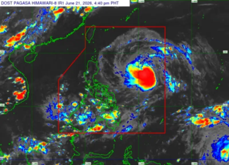
Bagyong Francisco, with international name Mekkhala, has intensified into a typhoon while inside the Philippine Area of Responsibility (PAR), the Philippine Atmospheric, Geophysical and Astronomical Services Administration (Pagasa) reported on Sunday.
Typhoon status and location
In its 5 p.m. bulletin, Pagasa said Francisco became a typhoon around 2 p.m. The center of the storm was last spotted 820 kilometers northeast of Eastern Visayas. It packed maximum sustained winds of 120 kilometers per hour (kph) near the center and gusts of up to 150 kph, moving west-northwest at 25 kph.
Pagasa expects the typhoon to continue intensifying and may reach its peak strength by Tuesday. Tropical Cyclone Wind Signal No. 1 could be raised over parts of northern and eastern Cagayan, including Babuyan Islands and Batanes, by Monday morning.

Forecast track and impacts
While Francisco is expected to remain over the Philippine Sea throughout the forecast period, Pagasa has not ruled out a closer approach to Extreme Northern Luzon. The typhoon is forecast to move northwest until Wednesday before turning toward southern Japan.
According to Pagasa, the likelihood of Francisco directly affecting weather conditions in the country is low. However, it may enhance the southwest monsoon (habagat), bringing rain to parts of Luzon and Visayas in the coming days.