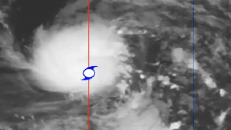
Bagyong Francisco, with international name Mekkhala, has entered the Philippine Area of Responsibility (PAR) as of 10:00 PM on June 20, according to the Philippine Atmospheric, Geophysical and Astronomical Services Administration (PAGASA).
Current Status and Location
The center of the storm was located 1,295 kilometers east of Southeastern Luzon. It is currently packing maximum sustained winds of 95 kilometers per hour (kph) and gusts of up to 115 kph.
Expected Intensification
PAGASA forecasts that the storm will strengthen and reach typhoon category by Sunday, June 21. The storm is expected to bring rains across various parts of the country due to the southwest monsoon (habagat).

Rainfall Forecast
On Sunday, areas including Siquijor, Camiguin, and the southern parts of Davao Oriental, Davao Occidental, and Sarangani may experience rainfall. On Monday, June 22, rains are expected over Romblon, Visayas, Zamboanga del Norte, Misamis Occidental, Lanao del Norte, Camiguin, Surigao del Norte, and Dinagat Islands.
Potential Typhoon Signals
PAGASA may raise tropical cyclone wind signals in some areas in the coming hours as the storm approaches.