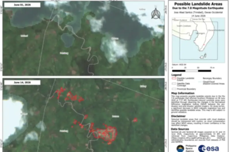
The Philippine Space Agency (PhilSA) released satellite data on Saturday, June 20, revealing landslides triggered by the strong earthquake that struck Mindanao on June 8. According to PhilSA, the landslides were identified in several barangays in Glan, Sarangani, and Jose Abad Santos, Davao Occidental. The total estimated area potentially affected is 137.87 hectares.
Satellite Imagery Analysis
PhilSA used images from the Sentinel-2A and Sentinel-2B satellites to detect vegetation loss before and after the earthquake. Vegetation refers to plants, trees, grass, and other crops growing in an area. The agency noted, however, that the results still need to be verified on the ground.
Support for Disaster Response
The satellite data from PhilSA aids the National Disaster Risk Reduction and Management Council (NDRRMC) in monitoring the situation and identifying priority areas for immediate response. Meanwhile, the death toll from the earthquake has decreased to 76, while over 1.45 million people—or more than 348,000 families—in Mindanao remain affected.