MANILA, Philippines - The Philippine Atmospheric, Geophysical and Astronomical Services Administration (PAGASA) has raised alarms as Tropical Storm Tino has rapidly intensified into a full-blown typhoon, posing significant threats to several regions across the archipelago.
Latest Storm Updates and Projected Path
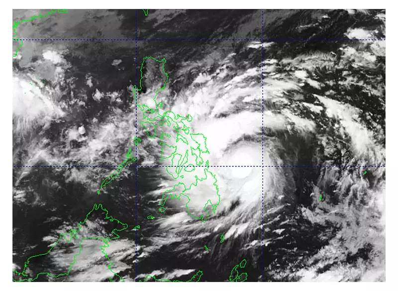
According to PAGASA's 4:00 p.m. weather bulletin, Typhoon Tino was last spotted approximately 1,035 kilometers east of Southeastern Luzon, gaining strength as it moves through Philippine waters. Weather specialists are closely monitoring the system's development and trajectory.
The typhoon is currently packing maximum sustained winds of 120 km/h near the center, with gustiness reaching up to 150 km/h. Meteorologists note that Tino continues to move westward at 15 km/h, potentially affecting multiple regions in the coming days.

Affected Areas and Precautionary Measures
PAGASA has issued tropical cyclone wind signals for several areas, with residents advised to take immediate precautions. The state weather bureau emphasized that while the typhoon's exact landfall remains uncertain, its effects will be felt across multiple regions.
Expected impacts include:
- Heavy to intense rainfall in affected areas
- Strong winds causing potential structural damage
- Rough sea conditions affecting maritime travel
- Possible flooding in low-lying areas
- Increased landslide risk in mountainous regions
Government Response and Safety Advisories
Local government units in potentially affected areas have been placed on high alert. The National Disaster Risk Reduction and Management Council (NDRRMC) has coordinated with regional offices to ensure preparedness and quick response capabilities.
PAGASA advises the public to:
- Monitor official weather updates regularly
- Prepare emergency kits and important documents
- Secure properties and reinforce structures when possible
- Follow evacuation orders from local authorities
- Avoid unnecessary travel, especially maritime activities
The weather bureau continues to monitor Typhoon Tino's development and will issue updates every six hours, or more frequently if significant changes occur in the storm's behavior or intensity.